Stubborn on Mount Defiance

After my hiking/camping plans fell through Friday, I woke up Saturday with my body aching to get on a mountain.

Since I drove so much Friday for nothing, I didn’t want to drive much, so I opted for a hike I did June 30th last year, Mount Defiance.

You can jump to all the pictures of this hike here.

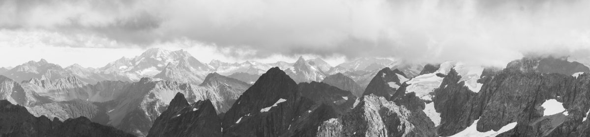
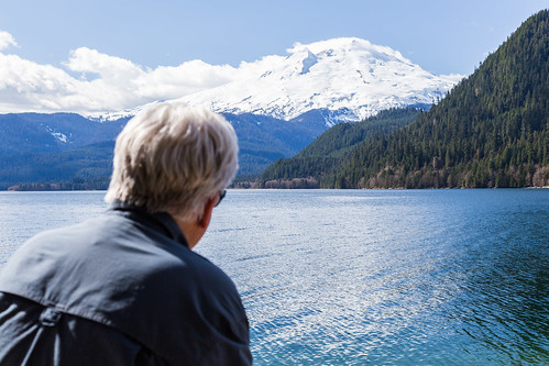
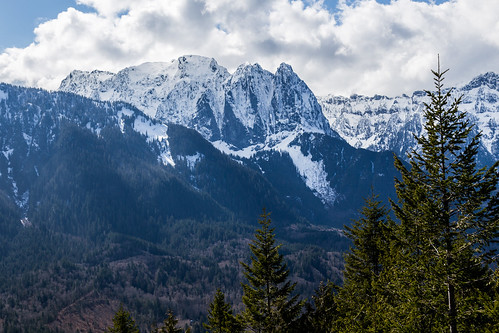
I wished I had the same sunny day that I had back then; instead I hiked into clouds at about 4,000 ft and didn’t quite break through them on Defiance’s 5,584 ft. summit.


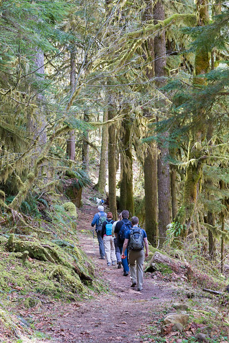
As I said last year, this hike is one of the best ones out on the I-90 hiking mecca only 45 minutes from Seattle. You’ll never be alone, at least on the lower half of the hike to Mason Lake, but it offers a great contrast of a forest walk and talus fields on the south side of the hike…


Untitled


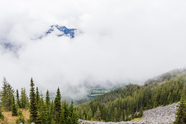
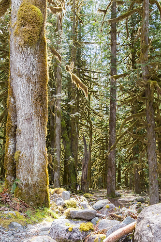
…then once you cross over the ridge and into the Alpine Lakes Wilderness, you have older growth trees and mossy boulder fields to envelope you as approach Mason Lake.


Approaching Mason Lake through the Alpine Lakes Wilderness


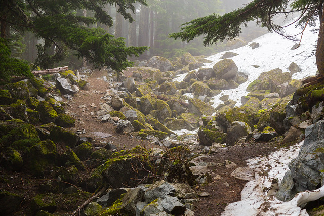
Mason Lake was mostly frozen over, though the area by the outlet stream was clear of ice.

Untitled

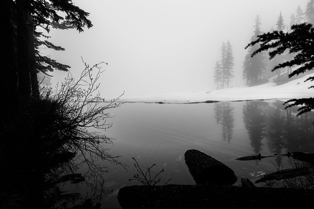
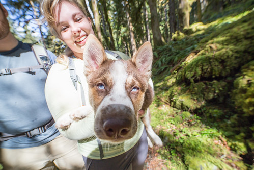
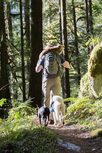
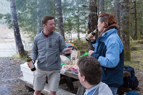
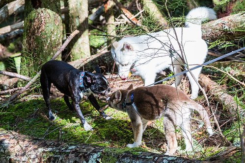
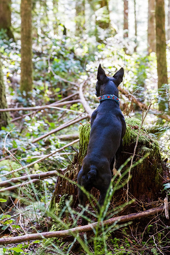
As you’ll find on most weekend days, there were several folks enjoying the view, including a couple with a Boston a bit smaller than Boomer.

Untitled

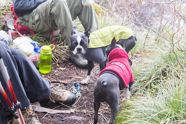
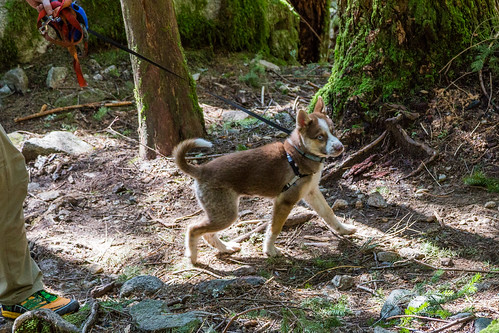
At this point, the battery in my Canon DSLR died and became a useless 4lb payload, so all photos from here on are with my phone. Really, there wasn’t much to see other than Boomer running around in the snow.


And crazy dog.


Boomer did great as always, and his superhero outfit kept him warm and dry the entire time.

At this point you can see we’re in a few feet of grainy, soft snow. We wandered around Little Mason Lake, trying to get a bead on the trail. Eventually I resorted to my GPS and started up the ridge.


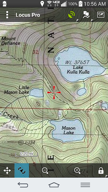
I got off course a little bit to the northeast, but then heard two guys, Ryan and Jared, descending, so I hiked up to them on the ridge (duh, that’s where I was supposed to be anyway), and they gave me an idea of what to expect. This time of year, there’s no defined trail other than the tracks of someone before you heading directly up the ridge. And their kicked-in bootprints were a help through some of the steep snow.

The last time we did this, we traversed south of the summit and then approached from the southwest. No traversing this time of year, as it’s a waste of time and there’s a possibility you’ll do a very long unintentional glissade southward.

As you can see above, this is nothing but a slog upward, in and out of trees. The last two hundred feet to the top have some exposed areas where you alternate between snow and rock scramble. Not technical at all, you just have to four-wheel it up there. Boomer, of course, had no problems and ran up and back to me several times.

I, however, became rather winded; more so than usual, and it occurred to me that donating a pint of blood the day before was probably why. Sure, they tell you no strenuous activity within 12 hours, but I was 24 hours into my recovery and was maxing out my exertion. So I simply took a lot of short breaks — hike up 50 ft, rest for a moment. Repeat. Several. Times.

Here’s a smile from the summit:

Summit selfie

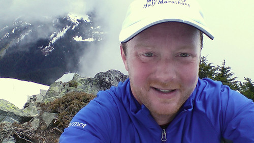
And Boomer frolicking like we just walked down the street:

Boomer on Mount Defiance; Lake Kulla Kulla below.

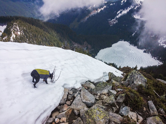
That’s Lake Kulla Kulla 1,800 ft. below.

The sun couldn’t punch through completely, but at times there was enough to cast faint shadows and fortunately enough to heat the rocks you see here. Boomer and I shared a sandwich, and after about 15 minutes on the summit, headed back down.

I did a couple of unintentional glissades (e.g. falling on the snow and sliding on my ass), but fortunately was able to arrest myself before running into any trees or rocks. It’s all par for the course. About an hour later I was back at Mason Lake and crossed the outlet stream again:


And then hiked up and over the ridge, where the early afternoon sun had burned away a lot of the earlier clouds over I-90:


Untitled

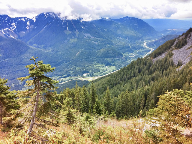
The hike was just over 9 miles, up and down 3,400 ft.

East Bank Baker Lake

It’s rewarding when you throw something together spontaneously and it turns out to be even better than you thought it could. That’s what this hike along the east side of Baker Lake turned out to be.

Three days before our hike, I ran into Sharon at a Microsoft cafeteria, and she mentioned that she wanted to get out on the trail and exercise her recovering foot from a serious break over the winter. She had East Bank Baker Lake in mind, and we decided that we do the hike and then find a spot to car camp.

Well, thanks to facebook, we had a group of six lined up within a day, and we all converged at the parking lot by 12:30PM (sorry we were late, Jimbo), and laid claim to one of the excellent campsites right off the parking lot and next to the now-dry Baker River. We pitched a tent to claim the spot, then headed out on the trail.

It didn’t take long for me to really like this hike. Because it’s under 1,000ft above sea level, the hike was full of moss-laden old growth trees. I could spend all day trying to capture their beauty in a photo and I took a lot of shots trying, though only a few came close to conveying what it’s like to be surrounded by all that greenery.

IMG_7671

So I would stop and let the group go ahead, snap a few shots, and then run to catch up.

The ants go marching....

This was a big hike for nearly 4-month old Rowan, and he hiked most of the way. Here’s a shot of Lynn giving him a break on the way out,

Hey Rowan!

And here’s Paul and the three dogs on the way back.Hitching a ride

We decided to take a break at the Noisy Creek campsite, which was recently upgraded with picnic tables, bear-proof food storage, and fire pits. We found a nice spot on the beach and chowed down. Here’s a shot of Jim enjoying a great view of Baker.

Jim blissin'

And Sharon soaking/cooling her foot in front of Mt. Shuksan to our north. We all were very pleased that her foot felt great, and in fact, was less painful on the hike than it was on our drive up there.

Sharon soaking up the sun and cooling her foot

Some cool little mushrooms finding their way…

IMG_7961

As much as I like to backpack myself away from other groups, I really enjoyed the convenience and relative luxury of car camping. There were some groups within a hundred yards of us, but we really felt like we had the place to ourselves. At one point, a neighboring camper came by and pointed out that there were some mountain goats grazing on the steep slope across the river to the east.

As the evening went on, we enjoyed wine, beer, and other upgraded adult beverages, feeding the fire from our bundles of wood.

The joys of car camping

Most of us got a decent night’s sleep, but Paul and Lynn woke up early and headed out before the rest of us stirred. We had a leisurely morning, Sharon cooked us breakfast and left by about noon.

This is a great hike, especially for new backpackers, as the trail is relatively flat and the campsites on the east side of the lake are really nice. But don’t plan to be alone over there, especially on the weekend during the summer, as I’m sure the sites fill up fast. Best to take a couple of days during the week to get some solitude and enjoy this beautiful place.

Another option is to kayak from the west side of the lake, filling your kayaks with gear or towing a small barge boat with your provisions, especially firewood for your campfire, as most of the available wood has been scavenged.

Thinking about backpacking for the first time?

I have some friends who are interested in backpacking that asked me about what kind of gear to buy and bring. There are many of articles out there, here are a few from WTA.org.

Here’s my personal spin on it:

You can spend all kinds of bucks on this kind of gear, and it gets more expensive as it gets lighter and adds features. And there are lots of articles out there on how to gear up. I think it’s best to be practical about it, figure out how much you like doing it, and invest accordingly. 


I have only been backpacking for two years, but after the first time I did it, I was all in and it’s what I look forward to most each year. I figure I’ve spent about $2,000 on all my gear and clothing. What’s nice about backpacking is that once you have the gear, the costs for each outing are only for the consumables (food, fuel, transportation,and time) and anything that wears out. So that $2,000 is an investment for decades. And you don’t have to spend $2K to get on the trail — you can do it for less than half that, especially if you can get some used equipment and maybe rent for a while.

This post won’t go into all the details, but it covers many of the major outlays and things that I didn’t know right away but figured out after backpacking a few times. REI has a more comprehensive shopping list to make sure you don’t miss anything. 

A side note about shopping: REI is a great place to explore, try out gear and shop, but they are on the expensive side. Being an REI member and reaping member dividends each year is a nice spending spree. Plus REI’s return policy is great if you’re not sure about some new boots or a backpack, things you absolutely MUST try on before you buy. For other gear, I buy a lot of stuff from steepandcheap.com; they have insane closeout deals going on all the time, plus more deeply-discounted items. They are the outlet for backcountry.com, another place I have bought many items from. I also buy from campmor.com, and everyone’s favorite, Amazon, though paying Amazon’s state income tax on their goods can send you elsewhere.


If you’re not 100% sure that backpacking is your thing, then you should considering renting the tent, sleeping bag and backpack if you don’t have a trail-worthy one yet and see how it goes. REI can set you up on the rentals.

Also, go to REI’s basement in downtown Seattle and see what used equipment shows up. Might find just what you need at a fraction of the cost.

I did a lot of scanning of reviews, listened to my friends and what they had, and I believe I have a decent kit that didn’t break the bank. I’m sure I’ll upgrade over the years as I need to, but this stuff can last a long time.


You should definitely check with friends to see if they have any gear they’re not using or have upgraded beyond.

Tent: If it’s for two of you, then you’ll definitely want a 2 person, 3 season tent. No real use in going out for a four season as they’re heavier and are you really going to camp in a snowstorm?

Everyone has their favorite brands, but in the end, for the most part, any tent in the same price range is going to be of similar weight, features, and quality. I have a Big Agnes Fly Creek UL2; it’s only 2lbs 9oz including footprint. While I like how light it is, its single opening on the end is not tent-mate friendly, and it feels sort of like a 2 person bivy. In other words, you better be really good friends with your tent-mate.

Other well-known tent brands with similar features are Marmot, MSR, Black Diamond, North Face, Kelty, Mountain Hardwear, and REI.

If it’s just one of you, then definitely consider a bivy or a one-person tent because they’re half the weight and size of a 2-person tent (though oddly about the same cost as a 2P).  I am looking at buying one this year.

Most tents come with a footprint, a layer of material that goes directly on the ground that you then place your tent on. This helps keep your tent dry from ground moisture and protects the fabric of your tent floor. Be sure to have one.

Backpack: This is where I insist that you go to REI and try a bunch on. Proper and comfortable fit while the pack is loaded can only be found by trying them on and walking around; REI is the place to go. They’ll set you up and ensure that the pack fits you well. You’ll probably want a pack that is at least 60 liters in volume. Mine can carry over 80, and with my camera gear I’ve needed it. My opinion is that each brand fits differently, so you may discover that, say, Osprey packs fit you better than Gregory, Deuter or REI. I started with an REI pack, but upgraded to a Gregory because it can more comfortably take bigger loads. I have a smaller Osprey dayhiking pack.

Sleeping bag: There are a zillion out there. The big thing again is the tradeoff of performance, usually focused on insulation/temp range, vs. weight. I have a North Face 0-degree mummy bag. For the most part it’s overkill, and I’m not a huge fan of the mummy shape. But if you want to be warm, that’s the way to go. I also have a Mountain Hardwear 35/50 Flip, which is nice because depending on which side of the bag you sleep on, it provides warmth down to 35 or 50 degrees, and if you sleep in thermal underlayers, then that’ll give you additional insulation. 35-50 covers you for just about any mid-season trip, and it’s more than a pound lighter that the 0-degree. While goose down bags are warmer for the weight, I prefer the usually cheaper synthetic fill because you can wash it at home. And you’ll want to wash it from time to time.

You don’t want to sleep directly on your tent floor, because it’s hard and cold. Get yourself a sleeping pad, whether it’s foam or inflatable. Honestly you don’t need a full-sized one because your feet don’t really need a lot of padding and socks will keep them warm. But do have one for your knees on up.

Camp stove: We always share our stoves, so no worries initially, but you’ll need one if you’re going out on your own. There are lots to choose from; most folks go for the propane canister-based ones like JetBoil and my super-tiny MSR PocketRocket. The Jetboil is nice because it’s an all-in one design (fuel, pot, burner, etc.), and works well in the wind. But it’s expensive, relatively speaking. The 8oz. propane fuel canisters last a few days. With my PocketRocket, I get more than 90 minutes of burning time with a single canister; considering you can boil a pot of water within about 3-4 minutes, that’s a lot of meals.


Poles: With a full backpack, your center of gravity is much higher and tripping or turning an ankle with all that extra weight means a much great risk of serious injury. Poles help to stabilize you, give your legs a little less to pull up, and they most definitely help your knees on the way down.

Water purification: You quickly discover how essential water is to life when you’re backpacking. Any freeze dried food is practically inedible without boiling water, and of course you’ll want safe water to drink and to clean yourself and your dishes.

You can buy a pump filter, use tablets, a UV stick, gravity filter, or an inline filter, and some folks use a combo of those. Each has its own merits, but the goal is to neutralize all the parasites and bad bacteria from the water, and each will do that. I have a pump filter which produces very clean, pure, neutral tasting water. But I recently also bought an in-line filter called the Sawyer System which claims to be able to filter over 200,000 gallons water in its lifetime, it costs less than $30, and weighs only 3 ounces vs. about 16 ounces for my pump. You also need the bags that go with it, because you squeeze the water from the bags through the filter. Here’s a starter kit from Amazon that costs about $21. Honestly I think everyone should have a Sawyer kit around the house, just in case something happens and your water utility shuts down. I could go down to Lake Washington or find a local stream and get all the potable water I need from it.

And you’ll need some Nalgene bags to store your water at camp. I like the big Nalgene bags because they’re light and compress down to a very manageable size.

When on the trail, most of us use Camelbak water bladders. Some prefer bottles. Nice to throw some Nuun tablets in there to make the water a little more appealing and add some electrolytes.

Food: While some may be more creative and bring their own home-made meals, for me, it’s a combo of bars, gels, blocks, and commercial freeze-dried offerings. REI and Fred Meyer have a good selection of the typical freeze-dried meals; they’re not gourmet, but after burning a few thousand calories on the trail, this stuff can taste pretty damn good. I also bring along extra proteins like chicken and salmon in foil pouches and add it to the freeze-dried meals to boost the flavor and nutrition. Some folks have their own food dehydrator, and that works too. Adding boiling water to it makes it edible again.

Nuts, peanut/almond butters are good choices; trail mix, anything that’s high in energy and protein is good. And it’s customary to share each your meals around the group, so we’re not bored to tears with our one meal. Again, though, be mindful of the weight you bear. We generally just eat straight out of the pouches to minimize cleanup. Make sure you have a utensils and a cup, too. Simple lightweight plastic ones will do well.

Other Needs:


Best to have some stuff sacks to sort your stuff out. I have one for personal hygiene (wash clothes, TP, contacts+solution, toothbrush+paste, DO, soap, etc.) and one for eating (utensils, cups, stove, pots, etc). I also have a stuff sack for all my clean clothes that is reversible, meaning that it’s flannel on the inside and nylon on the outside. I stuff it with clothes and use it as a pillow. 

You should also have at least a couple of compression sacks. Your sleeping bag might come with one, but I have three, and one of them doubles as a dayhiking pack. I put my sleeping bag in one compression sack and it compresses it down to the size of a volleyball. Also, I compress my clothes (in their own stuff sack) with my tent into another.
You must always bring a rain/wind shell. Doubles as a bug shield. Bugs are almost ALWAYS a problem, unless you’re camping up high (like over 7,000 ft) in rocks and away from water. Bring bug juice, the more DEET the better, but really, you’ll want as much non-penetrable clothing as possible, and a rain shell works well.

Bring a hat, maybe one with a brim, to keep out the sun/rain. I have the ubiquitous Seattle Sombrero, but there are other styles that are just as good. Consider, too, in investing in rain pants. Misery is being soaked to the bone, shivering in your tent. A wool hat and light gloves are nice to have during the cool night. You won’t always have a campfire.

No need for cotton. At all. Bring synthetics and/or wool. Wool socks are great. Also bring synthetic shells, zip-off pants, layers. Even on the cooler days, when hiking and snowshoeing, I’m usually down to a single layer. 
Bandana. Always a use for a bandana. Sweat rag, makeshift cap, bandage, who knows.


First aid kit. Yes, you’re likely to have co-hikers that have a kit, at least make sure *someone* has a good kit before heading out.

A small plastic spade is useful for when nature calls, because there’s not always a privy available and you need to make a hole and bury it.

A sitting pad is very useful; as nice as a log or rock to sit on might seem, your butt will get sore, especially after a full day of hiking. Pads come as foam pads or inflatable ones. You can also use your sleeping pad, but it may not be as tough and puncture-proof as one made for sitting.

You need something to cover/protect your pack if it rains. Nothing’s worse than a rain-soaked sleeping bag, so be sure to at least bring a trash bag big enough to envelope your backpack when hiking.

Headlamps. They are so effective, especially when nature calls in the middle of the night. Preferably one that has a red LED so as not to kill the night vision of your fellow campers.

Extra zip-locs and a Trash bag. Hike it out. Share the load there.

Boots/footwear:

There’s been a revolution for many in the footwear arena. Lots of folks are hiking with minimalist footwear with little to no heel or arch. Not me. I’m old school, and when backpacking, I want a competent boot to protect my feet from rock edges, support my ankles, and give me nothing to worry about down there. Don’t go cheap here, expect to invest at least $150, and they should last a long time. Be sure to break them in on a few hikes before going out with a heavy backpack. Also consider replacing the insoles with something like Superfeet; it gives me extra arch support. I rarely have any problems with my feet.

Bring some camp shoes for around the campsite so you can get out of your boots and let them (and your feet) air out. While some bring flip-flops because they’re so light, I prefer something with toe protection, because in the middle of the night you don’t want to stub your toe on a rock or root. Even a cheap water shoe will work. I carry Keen sandals, but they’re heavier than I’d like and am considering a downgrade to something cheaper and lighter.

Technology:
You’re probably going to take your mobile phone with you, at least to take snapshots. You can be out in the middle of nowhere and if you climb a peak, you’d be surprised that you may get coverage. Not that I’d encourage it, but it’s nice to surprise your friends with an instagram from some awesome vista when they thought you’d be off the grid for a few days.

If you’re taking your tech, you’ll probably want some way to keep it charged. I have a solar-charged extra battery; fully charged it will recharge your phone twice. And itself will recharge from the sun in about 13 hours; you can hang it on your backpack.

Downtime: 
Most of my trips are busy — meaning we’re always doing something. Once we make camp, we usually refuel and then explore the area with some more hiking. Then back to camp for dinner, drinking, chatting, and then off to sleep. It’s nice to be able to settle down with a book or some other relaxation.

Heybrook Lookout

I’ve driven past this hike on US 2 countless times with grander adventures in mind. But it was a great day to get my friend Paul and Lynn’s new husky Rowan out on the trail.
IMG_6882

The 3-month old pup did very well on the leash, leading Paul much of the way, while watching Boomer and Kalea run ahead and come back.

The one mile or so hike up to the lookout is rewarded with a nice view across the valley to Mt. Index, with Lake Serene below, though not visible.
IMG_6908

On the way down, the dogs played a bit more.
IMG_7022

And Boomer actually heard a squirrel.
IMG_7038

Heybrook is a nice short hike that has some uphill stretches to get you warmed up. It’s a fun hike if you don’t have a lot of time.

Hiking List — My Treks in Washington

Living for more than seven years in Kirkland puts me within a few hours of many of the best hikes in the States. Friends often ask what hikes I’ve done and which ones would be fun for them. Below is a categorized list of the hikes I have done, with the intention that it will encourage hikers and backpackers of all skill levels to get out and enjoy this beautiful state.

Most of my hikes from 2013 and later are pictured in my flickr gallery.

Each hike is rated with a number and a letter. 
The number indicates difficulty, on a scale of 1-5:

1 — Great for anyone, even children
2 — Easy hike where you might break a sweat, but doable for most
3 — It’s a workout in at least a few places; you should have no difficulty if you’re somewhat in shape. Be sure to wear competent footwear for hikes at level 3 and above.
4 — Definitely should be prepared for a workout for much of the hike; better for those who are fit and looking for a challenge
5 — Most difficult; you should be prepared for strenuously steep areas, difficult terrain, and/or an exceedingly long trail. Best to do this only if you’re in very good shape and ready for a rewarding challenge and have done some 3’s and 4’s beforehand. 

The letter is my subjective rating of the beauty and awesomeness of the hike; generally I don’t go on hikes that have nothing to offer, so the scale starts with the assumption of being worthwhile.

C — Worthwhile vistas, lake views, serene forests
B — Great views, uniquely beautiful, shows off the PNW
A — Awesome! must visit, once-in-a-lifetime experience

A ‘+’ on the rating means it’s a little more than the designated rating.

Because these hikes vary a lot in altitude and climate, you should check for recent trip reports before heading out. And always check the weather conditions and be prepared with the ten essentials. Hikes with a * are late-season hikes, where snow can persist through July in some seasons.

I have organized these in categories.

Peak hikes — hikes that lead to a spectacular vista and the satisfaction of doing it ‘because it’s there’:

  • Kamikaze Falls (2/B) and Mt. Teneriffe (5/B) – The relatively short hike to the pretty falls can be augmented with what I believe is the most demanding hike along the I-90 corridor – all the way to the top of Mt. Teneriffe. The hike up the mountain starts up a somewhat hidden route to the right of the falls; there are a couple of ways up, but once you hit the ridgeline, the path fades and all you do is grind up the ridge to the summit. It’s steeper than Mailbox peak as you climb the top 2,500ft. It’s near Mt. Si, and is a good ‘upgrade’ if you need a fitness test and want to avoid the crowd on Si. The only downside is the parking lot at the school bus turnaround is very small; you have to get there early to get a spot
  • Bandera Mountain (3+/B) – Nice hike that takes off from the Mason Lake/Ira Spring trail and heads up rather steeply to its peak. A good workout out on I-90.
  • Granite Mountain (4/B) – a thigh-burner, but loaded with berries at the right time of year. Popular hike; best to wait until mid-summer for the snow to melt off, as there are some dangerous avalanche areas through spring. Great 360 vista from the lookout at the top.
  • Mt. Dickerman* (4/B) — another thigh-burner off Mountain Loop Highway, with spectacular cliff views from the top. 
  • Hidden Lake* (3/A) — up in the North Cascades – a great hike to a lookout perched on top of a pile of rocks and beautiful vistas. Somewhat similar to Granite Mountain. Technically dogs are not allowed to the lookout, as the last 1/4 mile of this hike crosses into the North Cascades National Park. Lots of campsites, some around the Lake and others just off the trail before the last climb up to the Lookout. Doable in the winter via a more direct and less avalanche-prone route, though the traverse just before the lookout can be a bit dicey — ice axe and self-arresting skills recommended.
  • Mount Washington (3/C) (off I-90) – long and modestly interesting hike.
  • Mailbox Peak (4+/C) — The well-known fitness test. 4,000 ft of climbing over 2.5 miles. What fun! Crowded hike, so get an early start.
  • Mount Walker (2/C) (east side of Olympic peninsula) – take the hiking route, not the road.
  • Mt. Defiance* (4/B) — Similar to Granite and Bandera, this longer hike offers everything a Cascades hike can muster: picturesque Mason Lake, a beautiful meadowy traverse, and then a final grind to a 360 vista, towering over I-90. Baker, Rainier, and Glacier peaks all in view on a clear day. This is a very satisfying and somewhat rigorous hike. Better to wait until June for the snow to melt away, otherwise trailfinding can be difficult.
  • Navaho Peak (4/B+) — the link describes the hike to Navaho Pass; once to the pass, follow the trail to the right (east) upward along the ridge to the peak, which gets rather steep toward the summit. It’s a long day hike, but you get unparalleled views of the southern slope of the Stuart range including full views of the peaks that make up the Enchantments. Don’t worry about the road closed signs, because the road ends just at the trailhead (Stafford Creek). Popular overnight campsites appear well before you get to the pass along a creek; you can dayhike from there up to the summit the next morning. It’s a satisfying sampling of what the Teanaway area offers.
  • Mt. Adams (5/A) — Hike up the second tallest peak in Washington! Typical plan is to hike the first day up to the many campsites scattered around 8,700-9,000ft on the south side of the volcano. Then wake up well before dawn to summit at 12,276ft. Endurance and strength at altitude is a must, but it’s a non-technical hike. Bring an ice ax, crampons, and poles to assist, especially while glissading down much of the snow-covered trail. Permit required. Test your fitness at altitude beforehand by making the dayhike up to Camp Muir on Rainier.
  • Little Si (2/B) — Nice short hike to stretch your legs and get a little bit of everything — old mossy forest, rocky climbs, and a nice vista at the top. Nice for visitors who want a sample of hiking in the Cascades without too much work.
  • Mt. Si (4/C) — Everybody does Si once in their life. Seriously, you don’t have to. Do another hike here and avoid the crowds and parking lot chaos. Do Bandera, Mt. Defiance, Granite Mountain or Teneriffe instead.
  • Rattlesnake Ledge (2/B ) – Nice after-work hike during daylight savings time; technically not a peak but a ledge/cliff looking east. Short hike that goes up a ridge with great views of the western slope of the Cascades. VERY popular; keep dogs and kids from the cliff edge. 
  • Mt. Pilchuck (3/B) — VERY popular hike that is only 1.25 hours from Seattle that takes you high up on the western edge of the Cascades. 360 degree views from the lookout. It’s nice that the road takes you up over 2,000ft to the trailhead. The trailhead is closed until April/May, ending at the Heather Lake trailhead, so wait until summer. Start early to avoid the crowds or wait until later in the day to catch the sunset. Bring a headlamp as the trail can be tricky after dusk with the roots and rocks.
  • Bald Mountain (3+/B+) — Relatively quiet but very beautiful hike, passing dozens of tarns and ultimately ascending a rocky precipice that overlooks Spada Lake, a water source for Seattle. Lots of places for secluded overnight camping among the tarns, but buggy before September.
  • Park Butte* (3/A) — Spectacular lookout vantage point for unparalleled views of Mt. Baker. You can overnight in the lookout on a first come basis, otherwise there are lots of campsites along the many side trails. We camped down at Mazama Camp well below the lookout and it was very buggy in August. Other nice campsites are up along the lower part of the Railroad Grade Trail with even better views of Baker.
  • Cedar Butte (2/C) — Unremarkable hike through moss forests to a limited vista between Rattlesnake Ledge and Mount Washington.
  • Beckler Peak (3/B) — Nice meandering hike that follows along an abandoned forest road before winding through the woods, climbing steadily to a great rocky vista right in the middle of the Cascades. Big views in all directions.
  • McClellan Butte (4/B) — A climber that winds its way around the peak ridge before presenting you with a challenging scramble, which I have never done due to snow.
  • Vesper Peak (4+/A) — I hiked this on a cold and foggy August day, so I can’t attest to the views, but the pictures I’ve seen seem to make the workout worthwhile. This trail starts in the forest, the opens up into a meadowy/brushy area, never stopping its ascent. After a long traverse of a scree field, you come to Headlee Pass, where dozens of short and mercifully not-too-steep switchbacks gain you the pass. Then you traverse across to Vesper Lake, where now the fun begins. Head up left of the lake and you’ll eventually reach a seemingly endless stretch of granite climbing relentless to the peak. Follow the cairns for the easiest route. At the top, enjoy (purported) awesome views to Copper Lake and many other peaks in the center of the Cascades.
  • Snoqualmie Mountain (4/B+?) Another foggy/cloud-shrouded summit on the day I hiked it, but others assure me the views are fantastic. This uses the same trailhead parking lot as Snow Lake, but avoids the mob on that trail; the trailhead is 50ft south, heading off into the brush. The hike spends little time before you’re hiking up a boulder-filled gully endlessly before switching to a more forest but still steep hike/scramble. Once you get within 500ft of the summit, a network of trails all seem to eventually lead to the summit or the false south summit. Some trails offer exposure, while others stay off the steep ledges. A great workout for sure; best to get an early start to avoid the sun on this west-facing hike.


River-following hikes:

  • Lime Kiln trail (1/C-) – Brushy in the summer but includes some old logging artifacts including a kiln (surprise!). Might be best early in the season before the undergrowth develops. Its 7 miles might be too long for children. I think this hike is overrated and gets more attention than it deserves.
  • Duckabush River Trail (2/C) – eastern Olympic Peninsula; easy river walk that meanders along; after about 4 miles it heads up the river valley wall through an area that burned in 2011/12 – pretty eerie and cool. Nice drippy-day hike, but it takes a while to get to the trailhead from Seattle. It is not far from The Brothers, those twin peaks along the Olympic skyline visible from Seattle.
  • East Fork Foss River (2/C). Nice between-season river hike that offers a forest canopy, some old growth, and ultimately an opportunity to get down to the river.
  • Boulder River Trail (1/C) — An easy river walk that gives you the choice of a short hike to snap pictures of the waterfalls — bring your tripod — or you can continue several more miles to additional falls. I stopped at the first falls and spent an hour taking pictures.
  • Baker River trail (1/C) – pretty flat along the Baker River (duh).
  • Tin Cup Joe Falls (4/B) — this hike follows the Middle Fork Snoqualmie River to the Cripple Creek bridge where you depart onto an adventure of route finding and crawling over blow downs. The trail has all but disappeared, so go with a friend or two. The falls at the top are spectacular, though we barely saw it on a very rainy, miserable day. Here is another trip report with more details. If you’re up for a bushwhacking adventure with plenty of opportunities to injure yourself, try this! The falls are spectacular and rarely seen. Think Indiana Jones.
  • Twin Falls State Park (1/C) — GREAT first hike for young hikers, culminating in a bridge overlooking the falls. Follows the South Forth Snoqualmie River in North Bend.
  • Perry Creek to Mt. Forgotten Meadows — (3/B) Do this hike if you’re looking for views along a dramatic creek valley, in and out of forest and talus slopes. Cross the creek and head up the long switchbacks to the meadows and enjoy a huge vista over the Shake Creek valley and Mt. Forgotten. I consider this as much a vista hike as a river hike. 
  • East Bank Baker Lake (2/B) — Not a river hike, but this hike follows the eastern shore of Baker Lake. Hike to the Noisy Creek campsite mid-lake (9 miles r/t from the parking lot), or just dayhike it and car camp at one of the many campsites at the trailhead. This is a great hike that meanders along the woods just east of the lake. Lots of moss and a few creek crossings on this popular trail. Once on the point near Noisy Creek, a grand vista of Mt. Baker over the lake appears.
  • Big Quilcene River to Marmot Pass (3/B) — A five mile hike to the pass, steadily gaining 3,500ft. The first 2/3rds of the hike is in forest along the river, then it breaks up and away and across long stretches of exposed scree and dirt, with plenty of wildflowers along the way. Nice camping at Camp Mystery, and also just below and NW of the pass there is a large meadowy area with a few sites facing the Olympics high above the Dungeness River valley.
  • Eagle Creek, Oregon (2/A) — This trail off the Columbia River climbs slowly along Eagle Creek, following an often precipitous and sometimes narrow trail that was blasted from the side of the river canyon. After a few miles you come upon a series of dramatic falls of Eagle Creek and other creeks that come in from the canyon sides. Bring your camera and a tripod, but know that you will not be alone; this is a very popular hike, and there are many campsites toward the end of the hike where it meets up with the Tanner Butte trail, forming a monotonous 25-mile or so loop back to the Columbia River.
  • Suiattle River Trail (2/B) — The recently rebuilt Suiattle River Road gains hikers easy access to the trailhead that was largely abandoned after years of closure and inaccessibility. This easy trail through old growth forests and lush undergrowth rambles up and down well above the Suiattle River. A few blowdows and many creek crossings are relatively easy managed. Campsites every few miles; one the largest at the 6.7 mile mark at the Canyon Creek suspension bridge, several sites with pit toilets on both sides of the creek. Great for new backpackers.
  • Middle Fork Snoqualmie River to Goldmeyer Hot Springs (1/C) — If your vehicle can get to the trailhead, the hard part is behind you. Work on the road to the trailhead ends at the Middle Fork Campground, but you have several more miles along a road riddled with potholes, washouts and mudholes. Once  you reach the gate at the end of the road, it’s a 5 mile walk on the continued road to popular Goldmeyer Hot Springs (reservations required).
Alpine Lake hikes  hikes that travel through trail forests that lead to a serene lake view surrounded by peaks and ridges:

  • Lake 22 (3/B) — Very typical and popular hike that switchbacks along Twenty-two creek to a beautiful alpine lake cirque with towering Mt. Pilchuck above.
  • Heather Lake (2/B) Near Mt. Pilchuck; like Lake 22 but shorter. Great for snowshoeing on a clear April/May day.
  • Goat Lake (2+/B) – A somewhat long hike to a pretty alpine lake. Take the lower route along Elliott Creek on at least one leg of the out and back to the lake. The upper trail is pretty boring, though it is running-friendly if you’re up for it.
  • Blanca Lake* (4/A) – BEAUTIFUL azure-colored lake surrounded by mountains is a just reward for the hike up and then down to it.
  • Rachel Lake and Rampart Lakes* (4/B), Very popular hike to Rachel Lake, but don’t stop there! – continue around and up behind Rachel to the Rampart Lakes – a great place to wander around a myriad of pothole lakes and nooks and crannies. Great for camping, as you can dayhike up to Alta Mountain. Awesome just as day-hike, too.
  • Marmot* (3/A) and Jade Lakes* (4/A) — Read my trip report that describes how to get to Jade Lake, which makes this trip an ‘A’ in beauty. Marmot is a nice destination, too, but Jade is simply one of the most beautiful places I have ever seen. Spectacular azure lake filled with glacial silt with a cirque of high peaks and a snowy gap that can be hiked to views of Mt. Daniel. Definitely an overnighter — you can camp at Marmot one night (~8-9 miles from trailhead), then make the short and sometimes steep hike up and enjoy the next night at Jade Lake, dayhiking up the snow to the gap once you have made camp. Then you can return back to the trailhead the next morning. There are lots of other dayhiking and overnight routes to explore the area. Tuck and Robin Lakes are nearby, too. 
  • Blue Lake* (2/B+) (way out Highway 20 in North Cascades). There are some nice side trails too. Great hike for out-of-towners. It’s a long drive which has some pretty overlooks of Diablo and Ross Lakes.
  • Talapus, Olallie, (2/C) and Pratt Lake (2+/C) – old standbys from the same trailhead as Granite Mountain. Often used as a through-hike/overnight around to Denny or Melakwa Lake.
  • Snow Lake (2/B) — superhighway hike from the Alpental ski area parking lot. Avoid if you don’t like crowds, or go mid-week. Nice views once you break out of the long traverse through alternating forest and old avalanche areas. Also fun to snowshoe there, too, on a clear day.
  • Skyline Lake (3/C) — snowshoed this one; it’s a mostly-open trail that does nothing but go up until it comes to Skyline Lake. There are opportunities to snowshoe around and explore the ridge up and behind the Lake. Park for free on the north side of US 2, right across from the Stevens Pass ski area.
  • Lanham Lake (snowshoe) (2+/C) — Park in the Stevens Pass Nordic Center, a few miles east of Stevens Pass on US 2. It’s somewhat confusing, as the Nordic Center has groomed cross country and many mapped snowshoe trails, all requiring a purchased permit, and dogs are not permitted. However, the Lanham Lake trail is not part of the Nordic Center, and dogs are allowed (on leash, as usual). The trailhead to Lanham Lake also starts at the main entry point of the Nordic Center snowshoe trails, but you bear well left right at the start; after a few moments of trekking, you should see a sign that points to Lanham Lake. You will also pass under the roped boundary of the Nordic Center, too. Last time I did this, the snow was crusty and only needed Microspikes, though I did some post-holing at the lake. The small lake is within a deep cirque of treed slopes; not as dramatic as Heather, 22, Lake Serene and other lakes noted above.
  • Gothic Basin (4/B+) — Great day hike and even better as a backpacking destination; once you get to the basin, there are endless trails to explore and peaks to scramble up. Though ‘only’ gaining almost 3,000, it’s all over the last 3 miles, and some of it is a Class 2 scramble. Take your time and enjoy the views toward Monte Cristo as you grind upward. The basin is relatively bare, with meadows and grasses and few scrubby bushes among many tarns and campsites.
  • Melakwa Lake (3/B) — Starts out as a crowded hiking superhighway, but once you leave Denny Creek Falls, only the more serious dayhikers and backpackers will be on the trail. Beyond the crowds, the hike gets more serious as it climbs up the creek valley and then up to Hemlock Pass before a short downward hike to the lake. Nice view and lunch spot with chilly water to swim in even in September.
  • Enchantments (4/A) — Broadly regarded as the best multi-day backpacking trip in Washington. Hike up into a variety of Alpine Lake basins, each with its own vibe and look. You’ll remember the lakes’ names — Isolation, Perfection, Crystal, Leprechaun, Viviane, Inspiration…the list goes on and on. It’s a must-see special place with a very competitive pre-season permitting process, though some permits are held back for day-of walkup backpackers. You can also dayhike the near 20-mile trail, gaining over 4,500 ft and descending 6,000 ft, depending on which entry you choose. But in your hurry to get it done in a day, you’ll have very little time to really connect with this incredible place.
  • Summit Lake (2/B) — Short and easy hike to this lake just north of Mt. Rainier. Great first backpacking destination because of the huge payoffs of access to a swim-friendly lake, huge views of Rainier, a variety of campsites all around the lake, and you can take your dog!
  • Necklace Valley to Tank Lakes (4/A) — Some call Tank Lakes ‘The Other Enchantments’ because of the stunning lakes, vistas, and granite slabs that remind folks of the real thing; bonus is that camping here doesn’t require a permit. After 5 meandering miles along the East Fork Foss River, start up toward Jade Lake (not the same Jade Lake near Marmot Lake), and pass by several other jeweled lakes; once you pass Opal Lakes, you can either head up southeast toward La Bohn Lakes, or head up the gully southwest to the pair of Tank Lakes nestled high above the Middle Fork Snoqualmie River valley. Views to Summit Chief, Bears Breast, and Chimney Rock peaks dominate the south view, and a short walk reveals views to the many lakes that feed into the West Fork Foss River. It’s a lot of work to backpack up to Tank Lakes, but on a beautiful late summer weekend, it can’t be beat. 
Vista hikes — hikes that lead to or follow high-mountain trails with jaw-dropping views along the way.
  • Cascade Pass and up to Sahale Glacier*(4/A) — probably my favorite hike. Jaw-dropping vistas every step of the way, once you’ve switchbacked your way out of the forest. It’s 3 miles or so to Cascade Pass which is a spectacular endpoint on its own. If you have more gas in the tank, at least go up another 1,000 ft to Sahale Arm to the north side of the pass, the long cirque towering over Doubtful Lake and eventually culminating at the base of Sahale Glacier. The last half-mile to the Sahale Glacier Camp is an ambiguous loose gravel/scree scramble, but it’s completely worth it. Enforced campsite limits require a permit that can be acquired up to a day before. It’s worth taking a Friday off to claim the best campsites. No dogs allowed.
  • Spider Meadow/Phelps Basin* over Spider Gap to Lyman Glacier/Lakes (4+/A) — Beautiful forest trek to Spider Meadow, where you stop and camp for the night before going up and over Spider Gap in the snow and then down to Lyman Glacier and Lakes. Or you can push on up the steep switchbacks and try to snag one of the spectacular campsites below Spider Gap with a great view of the Phelps Basin. Definitely an over-nighter, though one-night camping at Spider Meadow is satisfying in its own right. The road to the trailhead is rough and slow-going.
  • Johnson Ridge* (3/B) – not far from Blanca Lake. The road to it is a bit rougher though. The big reveal is at the end of the ridge walk near Scorpion Mt., which has 360 degree views in the North Cascades . Nice place to camp but can be buggy. Lots and lots of flowers and berries depending on the season. Great place for panoramic views of the stars on moonless nights. Water source for the campsite is an invigorating and steep hike down to and up from Joan Lake, 500ft below.
  • Kendall Katwalk* (3+/A) 11+ mile round-trip to the Katwalk, a 5ft-wide path blasted into the side of steep mountain. This is part of the Pacific Crest Trail, so it’s not super-steep, but it is long and steadily upward. Can be a hot hike on a summer day, as much of it is exposed to the west. Best to get an early start. 
  • Longs Pass* (3/B) – out in the Teanaway area – nice but somewhat steep hike at times to a pass that reveals Mt. Stuart in all its glory. Mountain goats are common, too.
  • Artist Point (1/A) & Snowshoe (2/A) — Between June/July and September, the road to Artist Point is plowed out, enabling you to drive to a spectacular vista of both Mt. Baker and Mt. Shuksan. It’s a 3 hour drive from Seattle, but worth every minute. The snowshoe is second to none, too. Be SURE to go on a clear day, otherwise the long drive is not worthwhile.
  • Camp Muir (4+/B) — The very busy route out off the Skyline Trail from Paradise leads to the basecamp for those summiting Rainier. Opportunities for some glissading on the descent. Not really worth the trip unless it’s a clear summer day. Great workout with spectacular views. You can snowshoe it, too, in the winter, but it’s quite an effort.
  • Iron Goat trail  (1/C) – start at the main parking lot right along highway 2 (not the trailhead that is further west and off the road a ways) and hike up the left loop (NW), then come down the steep return trail that’s right above the parking lot. There are options to lengthen and shorten this historic trail. Not really a vista hike, but a good one for the kids on a nice fall day. Views into collapsing railroad tunnels makes this a great Halloween hike.
  • Ancient Lakes (1/C) — Great early season hike just east of the Columbia River and near The Gorge amphitheater. Very dry and dusty with sage brush, and keep an eye out for rattlesnakes. Popular with horse campers, so be prepared for their leave-behinds. HUGE contrast to hikes west of the Cascade crest. If you’re itchin’ to get an early start to camping season with a near-level hike, this might be a good choice.
  • Esmeralda Basin (2/B) — Beautiful example of why the Teanaway River valley is one of my favorite places to hike. Follow trail 1394 from the same trailhead for Ingalls Lake and Longs Peak, but stay straight instead of heading up to those great spots. 1394 meanders back and forth through the broad basin, with peaks on all sides; eventually climbing out of most of the trees. I turned off and headed up the ridge above Lake Ann and below Mt. Fortune. On a windy day with he peak being socked in, we headed back down after enjoying lunch on a rock island among June snowfields. Plenty of trails network this area and it’s a great place to wander on a multi-night backpacking trip.
  • West Cady Ridge to Benchmark Mountain (3/B) — Long-ish meandering ridge hike that is renown for meadows full of flowers that culminates at Benchmark Mountain, a peak that rises a few hundred feet above the trail. Great hike to log miles, but be aware that there are few, if any, water sources once you climb up to the ridge.
  • Squire Creek Pass (3/B) — Short but sometimes steep and scrambly hike up to huge granite slabs to set camp on with broad views of Three Fingers and other peaks. Great spot to explore from. 
  • Heliotrope Ridge (3/B) — Short hike through Mt. Baker Wilderness, climbing modestly, then crossing four streams — check trip reports before you go, especially during prime melt off in the Spring — before reaching a ridge that overlooks massive Coleman Glacier on Baker’s north flank. 
  • Maple Pass Loop (3/A) — Definitely one of the most beautiful hikes in Washington with jaw-dropping vistas nearly every step of the way. I recommend doing this loop counter-clockwise, as the slope is a bit less and the reveals are more dramatic. It’s a busy hike during golden larch season. It is dog-friendly, but remember not to cross into the National Park where this hike borders along one of the western ridges.

Design a site like this with WordPress.com
Get started